Wikimedia Commons · CC
Southwest · geology, not magic sand
Chamarel seven-coloured earth
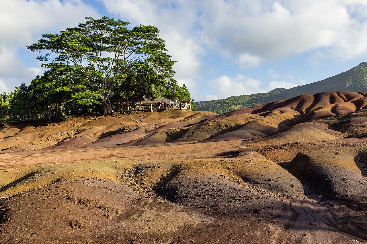
The seven-coloured earth sits in a forest clearing above Chamarel. The coloured dunes occupy only a few thousand square metres. Water and weathering of volcanic soil produced the stripes; the 'seven' is a visitor label more than a scientific inventory. The village takes its name from the de Chazal de Chamarel family, who received a concession here. The site is a paying viewpoint with paths and railings. Go for the geology and the southwest landscape, not for a secret. Pair it with Chamarel falls and a slow lunch in the village rather than a tick-list stop.
History
Why this place exists
Iron- and aluminium-rich sands that refuse to settle into one colour. A geological curiosity in a fenced garden, not a wilderness. The waterfall nearby is a different ticket or viewpoint — read the board.
First visit
To do
- Go early. Tour buses arrive.
- Do not treat the dunes as a sandpit.
- One southwest inland morning. Not with Île aux Cerfs.
- The waterfall nearby and a proper meal in Chamarel so the drive has a middle, not only a photo.
- The convex dunes after rain (colours deepen), the forest edge, and the difference between this site and the separate Vallée des Couleurs park — they are not the same place.
Tickets
Cheaper here
Buy at the official kiosk of the private park. A street tout with a photocopy is not cheaper; it is a problem.
Private paid site. We do not quote a rupee figure that will be wrong next season. Gate first.
Location
On the island
OpenStreetMap, live. Pins are the place, not a sponsored hotel.
-20.4272° S · 57.3806° E
The story
Chamarel was remote enough to keep a distinct village character — forests, game, coffee, and later rum. The coloured earth is an eroded exposure, not a beach. Hypotheses about the precise mineral sorting differ; present it as weathered volcanic soils with iron and aluminium oxides, not as a miracle. Origins of the colour banding are still discussed in local heritage writing.
What to look for
The convex dunes after rain (colours deepen), the forest edge, and the difference between this site and the separate Vallée des Couleurs park — they are not the same place.
Best time to visit
Early, or later afternoon. Midday tour-bus peak is the worst version of a small site. After rain the colours read more clearly, but paths can be slippery.
How to get there
Winding roads from the west coast (Grande Rivière Noire / Chamarel road) or from the south. This is a south-west day, not a Grand Baie afternoon.
Cost
Ticketed private/attraction site. Fees change. Verify at the gate. Old 'Rs X' screenshots are not a source.
Time needed
30–45 minutes on the dunes; half a day with waterfall, rum estate, and lunch.
Do not miss
The waterfall nearby and a proper meal in Chamarel so the drive has a middle, not only a photo.
Source / references
Heritage Bel Ombre Chamarel entry; Rhumerie de Chamarel public materials for the rum estate (verify hours separately).
How small the dunes are, how quickly the visit ends if you only came for a photo, and Chamarel village food. Also missed: combining it with Black River Gorges viewpoints on the sam…
Crowd: busy